
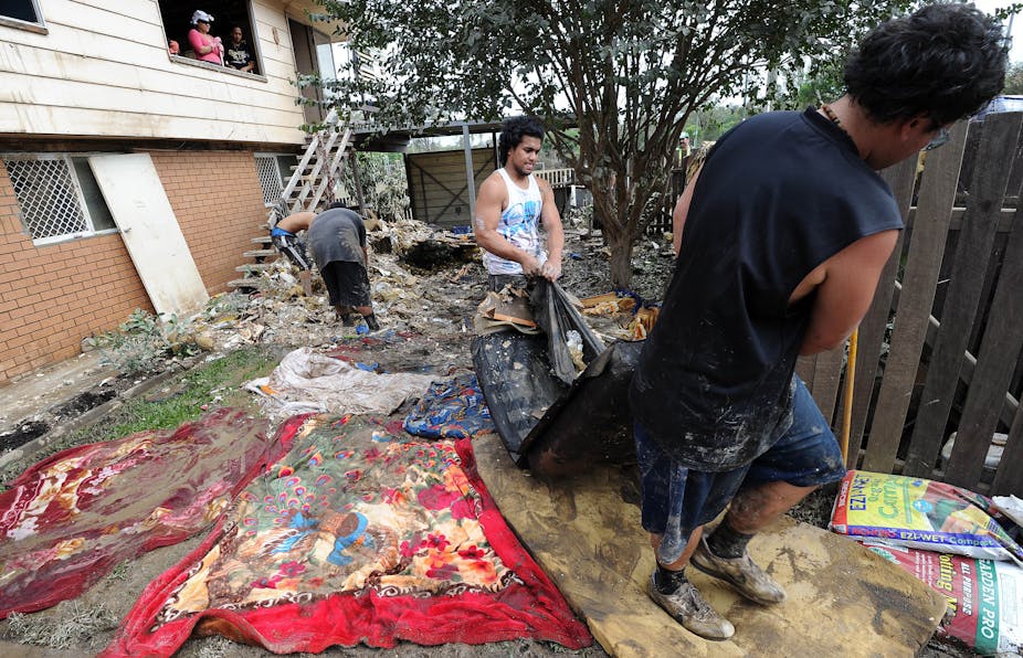
As many Queenslanders affected by January’s floods are realising, riverine flood damage is commonly excluded from household insurance policies.
And this is unlikely to change until councils - especially in Queensland - stop dragging their feet and actively assist in developing comprehensive data insurance companies can use.
Why? Because there is often little available information that would allow an insurer to adequately price this flood risk.
Without this, there is little economic incentive for insurers to accept this risk. It would be irresponsible for insurers to cover riverine flood without quantifying and pricing the risk accordingly.
The first step in establishing risk-adjusted premiums is to know the likelihood of the depth of flooding at each address. This information has to be address-specific because the severity of flooding can vary widely over small distances, for example, from one side of a road to the other.
Risk Frontiers is involved in jointly developing the National Flood Information Database (NFID) for the Insurance Council of Australia with Willis Re, a reinsurance broking intermediary. NFID is a five year project aiming to integrate flood information from all city councils in a consistent insurance-relevant form.
The aim of NFID is to help insurers understand and quantify their risk. Unfortunately, obtaining the base data for NFID from some local councils is difficult and sometimes impossible despite the support of all state governments for the development of NFID.
Councils have an obligation to assess their flood risk and to establish rules for safe land development. However, many are antipathetic to the idea of insurance.
Some states and councils have been very supportive - in New South Wales and Victoria, particularly. Some states have a central repository - a library of all flood studies and digital terrain models (digital elevation data).
Council reluctance to release data is most prevalent in Queensland, where, unfortunately, no central repository exists.
A litany of reasons is given for withholding data. At times it seems that refusal stems from a view that insurance is innately evil. This is ironic in view of the gratuitous advice sometimes offered by politicians and commentators in the aftermath of extreme events, exhorting insurers to pay claims even when no legal liability exists and riverine flood is explicitly excluded from policies.

Sometimes councils express concern over the quality of their flood data but this should not be a deterrent for releasing it. Dealing with uncertainty is an essential part of providing insurance, so this fear is not a legitimate reason for withholding data. The NFID database contains descriptions for each catchment expressing the degree of confidence in the underlying data.
At other times, liability concerns are invoked. These may be real as in the past some councils have encouraged or not actively limited property development on floodplains.
However, development mistakes of the past will be revealed in the next large flood irrespective of insurance. As we have seen in Brisbane, nature has little respect for the sensibilities of councils and land developers; the bigger issue is reducing the practice of allowing development in harm’s way.
Another issue is that many councils only undertake flood modelling in order to create a single design flood level, usually the so-called one-in-100 year flood. (For reasons given later, a better term is the flood with an 1% annual likelihood of being exceeded.)
Inundation maps showing the extent of the flood with a 1% annual likelihood of exceedance are increasingly common on council websites, even in Queensland. Unfortunately these maps say little about the depth of water at an address or, importantly, how depth varies for less probable floods. Insurance claims usually begin when the ground is flooded and increase rapidly as water rises above the floor level.
At Windsor in NSW, for example, the difference in the water depth between the flood with a 1% annual chance of exceedance and the maximum possible flood is nine metres.
In other catchments this difference may be as small as ten centimetres. The risk of damage is quite different in both cases and an insurer needs this information if they are to provide coverage in these areas.
The ‘one-in-100 year flood’ term is misleading. To many it is something that happens regularly once every 100 years – with the reliability of a bus timetable. It is still possible, though unlikely, that a flood of similar magnitude or even greater flood could happen twice in one year or three times in successive years.
The calculations underpinning this are not straightforward but the probability that an address exposed to a 1-in-100 year flood will experience such an event or greater over the lifetime of the house – 50 years say – is around 40%. Over the lifetime of a typical home mortgage – 25 years – the probability of occurrence is 22%. These are not good odds.
Recently, there have been calls for better elevation mapping and new flood studies. Both will ultimately lead to a better understanding of the nation’s flood risk. But a simple and effective solution at least in the short-term would be to compel councils to release existing flood data. Until this is done, there is very little incentive for insurers to widely accept riverine flood risk unless at very conservative (high) premiums.
Lastly, if flood data were more widely available then issues such as what does and does not constitute a flood for insurance purposes would become less of an issue.
The exact definition would quickly lose relevance as flood insurance for water damage in all its guises inevitably becomes more widely available and appropriately priced for.